The area around Vejle and the Egtved River valleys
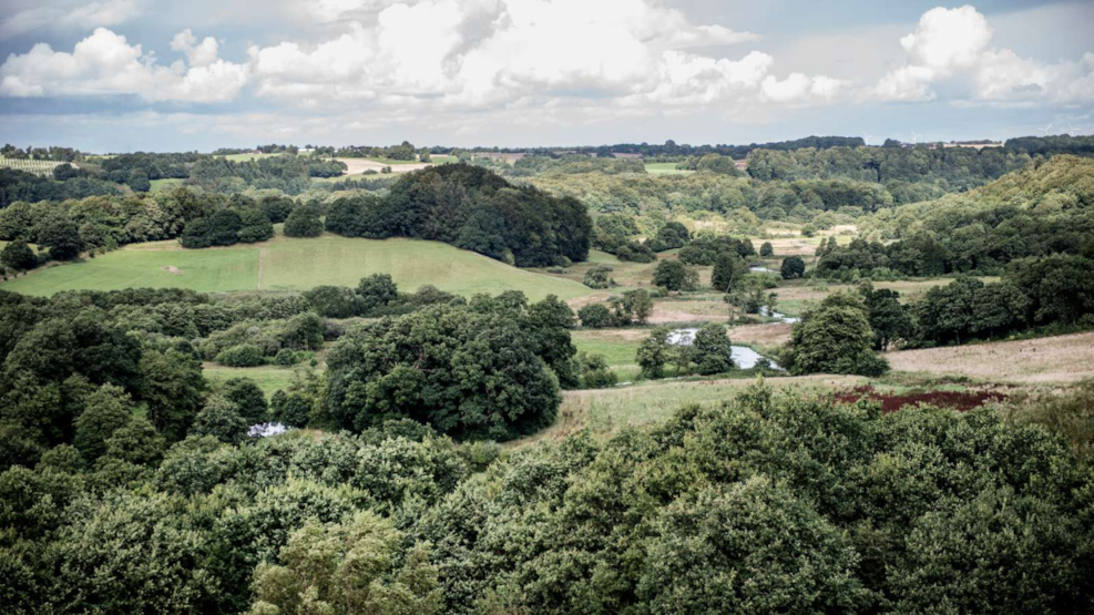
In this natural area, Vejle River and Egtved River converge, creating a breathtaking valley. Here, you'll find Tørskind and Runkenbjerg, offering a series of impressive views.
The landscape combines various natural types into a mosaic of hills, slopes, and wide valleys.
Hiking trails
Meander through some of Denmark's most stunning natural areas, offering unforgettable views over the valleys by Vejle and Egtved River. The terrain varies, with marked paths mainly on footpaths and some stretches on asphalt and gravel roads. To improve access to wet areas, footbridges and stepping stones have been installed, though waterproof footwear is recommended. The area, largely protected, is maintained by grazing horses and cattle, and at places, you'll pass through fenced areas via gates or stiles. Dogs must be kept on a leash, and feeding the animals is not allowed.
Experiences along the route
Vejle Ådal was formed during the Ice Age, shaped by thousands of years of erosion from melting glacier water, creating East Jutland's longest and most significant tunnel valley stretching from Vejle Fjord in the east to 20 km west of Vejle. This narrow valley, where nature alternates between open heathlands, lakes, dense vegetation, and agricultural lands, houses Egtved River. Vejle River meanders through lush, green meadows and thickets, bordered by drier and less fertile valley sides. Nybjerg Mill, protected against development, can be experienced through a network of marked hiking trails, following a significant landscape conservation in 1980. At Runkenbjerg, the confluence of Egtved River from the south and Vejle River from the north offers breathtaking views before they continue eastward to end in Vejle Fjord.
Make a stop at the Egtved Girl's Grave, discovered by farmer Peter Platz on February 24, 1921. Today, you can see the reconstructed burial mound and a small exhibition featuring a replica of the Egtved Girl's coffin and copies of her clothing and belt buckle. The hiking route includes the decommissioned Vandel railway, now Bindeballestien, where you can visit the cozy Bindeballe Merchant's House, now a traditional shop, museum, and café. Only Nybjerg Mill remains of the original 35 mills along Vejle River, now a private residence but historically significant, used for milling flour until 1991.
Trails in the area
- "Time Travel at Tørskind": A challenging 1.5 km loop with very hilly terrain, featuring listening posts where you can hear stories about the valley, the Ice Age, the gravel pit, and more.
- Birkelund: A 1.5 km loop, about 30 minutes, following hilly terrain through the valley's beech forests and meadows.
- Fortvad Bjerg: A 3.5 km loop, about 1 hour. This route takes you up to the heath of Fortvad Bjerg, where you can enjoy views over Vejle River and Runkenbjerg. Waterproof footwear is recommended.
- Runkenbjerg: A 4 km loop, about 1.5 hours. The journey leads to Runkenbjerg with fantastic views of the valley, ending with a walk through the Sønderkær meadow area.
- Tørskind and Søballegaard: A 3.5 km loop, about 1 hour, starting at Lihmskov Station's parking. Follow the Bindeballestien and continue over the meadows and through hilly moraine hills before returning along Tørskind Road.
- Refsgårde Overdrev: A challenging 2 km hike, about 1 hour, starting at Tørskind Gravel Pit and walking along the valley sides, offering fantastic views.
- Sønderkær: A 1 km trek, about 30 minutes, with a demanding incline through the Sønderkær area, where waterproof footwear is recommended.
- Turbinesøen: A 3.5 km walk, about 1.5 hours, through bush, lake, and bog in Egtved River Valley, passing Turbinesøen, a former power-producing lake."
- Nybjerg Mill: A challenging 4 km hike, approximately 2 hours, where you'll experience both sides of the Egtved River Valley. Tågelundgård Plantation: An easy 3 km walk, about 1 hour, through a conifer plantation and along heather-covered slopes.
- Egtved River Valley: A demanding 12.5 km loop offering beautiful views of both valleys and nature, with an elevation gain of 338 meters, taking 4-5 hours.
Download hiking brochures
- Brochure on the nature and trails of the natural area: Vejle Egtved Ådale folder.web.pdf | udeliv.vejle.dk
- Brochure for the trail at Egtved Girl's grave: Egtvedpigens-grav, folder.pdf | vejle.dk