Village hiking route Rans Togt
The village hiking route Rans Togt will take you through 14 villages in the Vejle area, each with their own character, history and life. The route is approx. 130 km long and follows the old country roads that wind across the landscape and offer local detours.
Village hiking route through Vejle and the area
Follow the Rans Togt Route – Vejle’s camino – and experience the charm of Danish villages. Here you will wander through 14 villages in the Vejle area, each with their own character, history and life.
The approx. 130-km long village hiking route Rans Togt is named after Bronze Age King Ran, who according to the legend of ‘King Ran and his Warriors’ was buried in the barrows of Firehøje. Read about Firehøje here.
About the route
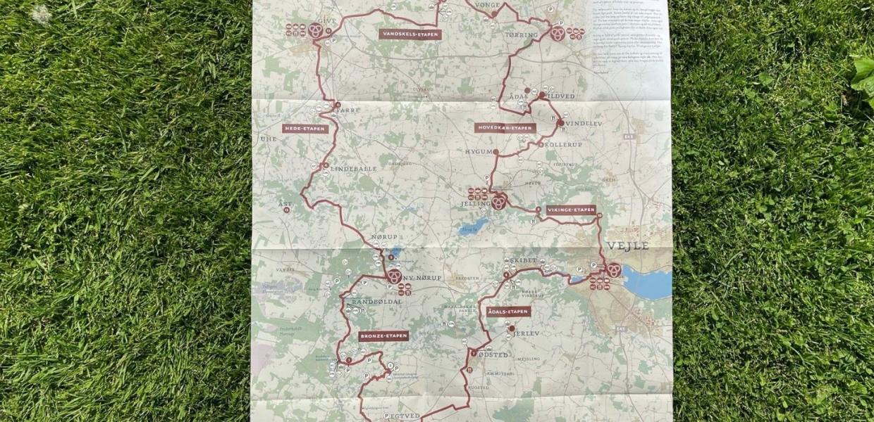
The route follows the old country roads that meander across the landscape and offer local detours along paths and gravel lanes. There are plenty of attractions along the route, such as the Land Art location Tørskind Grusgrav, the estate of Engelsholm Castle and the source of the river of Gudenåen. Nonetheless, the route is called a village hiking route due to the intention of relating the stories of village life – whimsical stories of people who are deeply rooted in their local communities. You will meet the locals and learn what makes their village special.
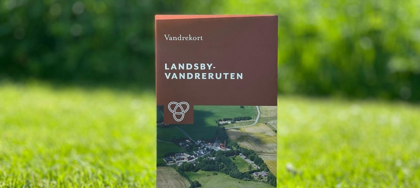
The kongran.vejle.dk website offers route information and links for social media so that you can learn more about the route that you are about to embark on. You can also buy a waterproof map of the hiking route from the Vandreshoppen web-store, at Økolariet in Vejle or at Museum Give. The map will show public toilet facilities, grocery stores, restaurants, public transport stops and accommodations.
Please note, the map is in Danish. You're welcome to stop by VisitVejle to get more information about the villages and areas for your hike.
Find the interactive map of the route here.
Please note, the map is in Danish. You're welcome to stop by VisitVejle to get more information about the villages and areas for your hike.
Stages of the route
Rans Togt has 6 stages, which pass through 14 villages. The stages are:
Bronze Stage – River Valley Stage – Viking Stage – Hovedkær Stage – Ridgeline Stage – Heath Stage.
Read more about the stages of the route and what they offer at kongran.vejle.dk or on the hiking route map.
Share your hike
Head out on the hiking route and greet those you meet. Maybe you will learn about local traditions and sample local delicacies. Visit the tourist office at VisitVejle to learn more about the hiking route. The route is signposted using the Rans Togt loop icon – so keep an eye out.
Remember to your experiences on social media using the hashtags #landsbyvandrerute and #ranstogs.